Plan. Process. Analyze and Execute.
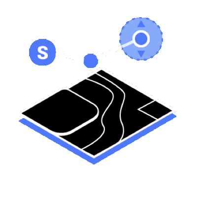
Mission Planning

Data Acquisition
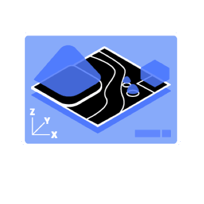
Area Maping
Data Analysis
Digitize the World Around You

Construction
Collect, measure and analyze data with accuracy across projects

Infrastructure
Easily perform detailed inspections on complex assets and structures

Energy
Safely inspect vertical assets and structures, with special optimizations for power lines

Public safety
Achieve rapid turnaround time for gathering on-site critical information

Agriculture
Get an in-depth understanding of your field to help you generate greater yields

Filming
Optimize previsualization to improve planning workflows across your team
Mission Type
 Waypoints Mission Planning
 Area Mission Planning
 Oblique Mission Planning
 Corridor Mission Planning

Create efficient flight paths using predefined waypoint actions and adjustable parameters like altitude, speed, gimbal pitch angle, aircraft heading and more. For more complex and tight missions that require high attention to detail, use 3D Flight Visualization to design and simulate tasks on existing 3D models.

With just a few taps on the screen, you can automate complex missions, allowing you to seamlessly capture imagery which can be processed to produce a variety of maps and models for further analysis, and to aid decision-making.
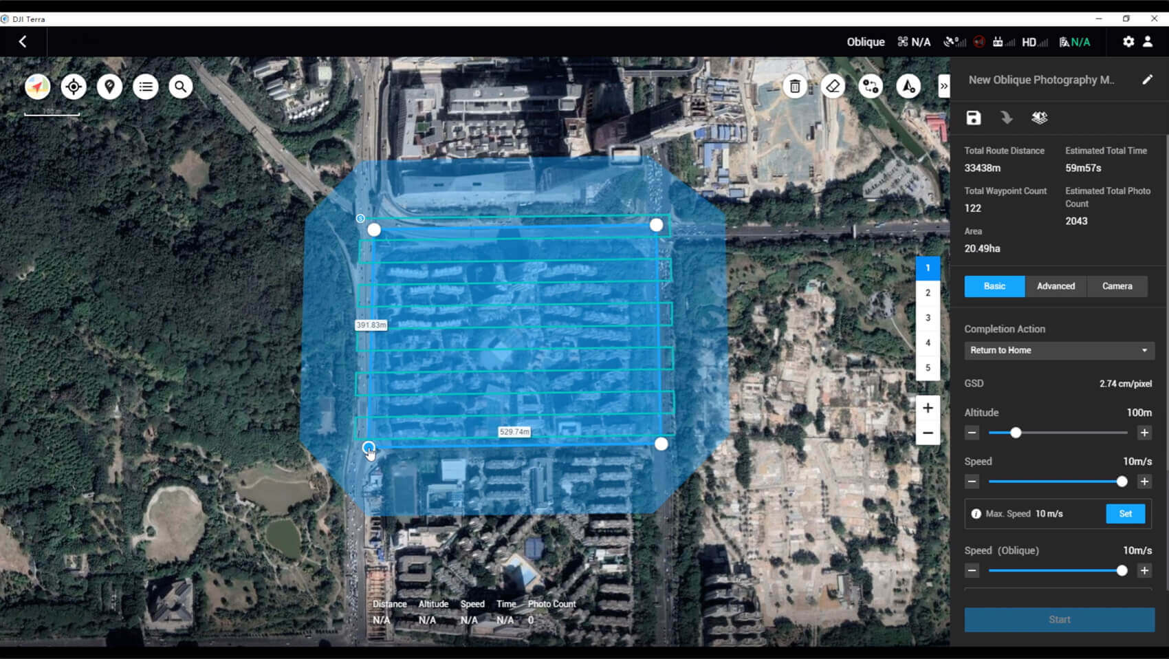
When accuracy is essential and details are vital to your critical operations, Oblique lets you capture a rich 3D model data set by adjusting the angle of the camera at a tilted angle, giving you an extra crisp view of the asset.

Create automated flight missions around roads and railways by simply drawing a line on the map. Adjust mission settings to change the total area mapped, giving you the flexibility to choose between creating high-definition 2D maps and 3D models or quick overviews.
Seamless Workflows, Accurate Results

Unparalleled efficiency and user experience
Import images with ease while navigating the intuitively designed interface effortlessly.
Bulk process up to 400 images/1 GB of RAM *, minimizing the wait time between field work and digital visualization.
*The processing capacity of 400 images/1 GB of RAM is estimated using the size of images captured using the Phantom 4 RTK. This is the equivalent of processing 8 gigapixels of data/1 GB of RAM.

Meet and exceed your project standards
Generate highly detailed 2D orthomosaics and 3D models with enhanced absolute accuracy by setting Ground Control Points (GCPs) and checkpoints, so you can measure and inspect with ease.
View a quality report of your mission to ensure the results meet your accuracy standards.

Compatibility and flexibility
Convert the coordinates of your maps and models into 8500+ major coordinate systems by simply selecting the output that fits your needs.
Incorporate POS data, GCPs, or both sets of data to create georeferenced maps and models with enhanced accuracy directly in the target coordinate system required by the project.
Mapping
2D Maps
Real-time Mapping
Quickly generate a 2D orthomosaic of the selected area in real-time. Not only is this ideal for creating detailed flight paths in remote areas but it’s also useful for time-sensitive missions that require quick decision-making on site.

2D Reconstruction
Generate high resolution orthomosaics, enabling you to get detailed and accurate measurement results for all your critical projects.

2D Multispectral Reconstruction
Process multispectral images to generate vegetation index maps including NDVI and NDRE. Create prescription maps for variable rate application using DJI’s Agras drones to improve crop yields while driving down costs.
*Aircraft supported: P4 Multispectral Multispectral Imaging Bands supported: Blue (B): 450 nm ± 16 nm, green (G): 560 nm ± 16 nm, red (R): 650 nm ± 16 nm, red edge (RE): 730 nm ± 16 nm, near-infrared (NIR): 840 nm ± 26 nm Vegetation indices supported: NDVI, GNDVI, NDRE, LCI, OSAVI.

3D Models
Real-time 3D Point Cloud2
When efficiency is key, quickly render and visualize a 3D point cloud of the mapped area. Make decisions based on the preliminary model and check for completeness immediately or plan 3D flights on-site.
2. Feature only available when using the Phantom 4 RTK (Remote Controller), Phantom 4 Pro + V2.0 or Phantom 4 Pro V2.0.

3D Reconstruction
Get sharp and realistic representations of your surroundings throughout various industrial applications, be it accident reconstruction, recreating thin power lines and complex vertical structures, managing major construction projects and more. The CUDA-based reconstruction algorithms are capable of quickly processing large amounts of data to deliver quality results.

The Beginning of Next Generation Mapping Solutions
Harness the power of AI-driven mapping solutions designed to take your industrial projects to the next level. Whether it’s object classification, site inspections and more, you can start developing task-specific mapping solutions to seamlessly carry out missions.

Data acquisition
Define mission objective, plan desired flight plan, and with a tap of a few buttons, autonomously collect critical data so you can achieve the required outcome.

Data acquisition
Utilize refined image recognition technology to generate 2D and 3D data, resulting in a more realistic representation of your assets, objects, surroundings and more.

Data Application
Implement tools and machine learning techniques, which can be used across a variety of different industries – like classification algorithms for identifying trees, objects, and other scenarios.

Execution
Take the required action, and enjoy more efficient processes with machine control – be it automated crop spraying, monitoring work sites, transporting materials and more.
Terra License Plans
| Feature/Version | Advanced | Pro | Electricity |
| Real-time 2D Mapping | |||
| Agricultural application | |||
| KML file import | |||
| 2D Reconstruction (Field) | |||
| 2D Reconstruction (Urban) | |||
| 2D Multispectral Reconstruction | |||
| Output Coordinate System | |||
| 3D Reconstruction | |||
| 3D Mission planning | |||
| GCPs | |||
| Electricity Application | |||
| How to buy? | Contact Us | Contact Us | Contact Us |
Contact Us
If you would like to purchase the product or become a dealer, please contact sales@scorpiondrones.com or leave your contact details and we will get in touch with you shortly.