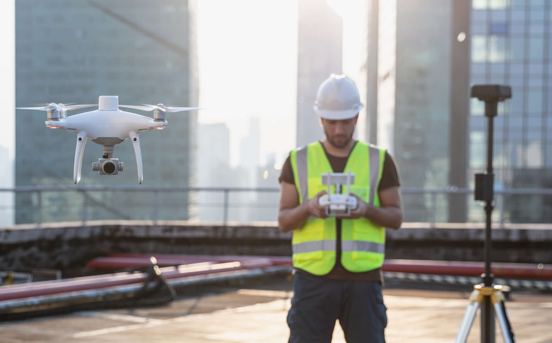
Mapeo de próxima generación
DJI ha repensado su tecnología de drones desde cero, revolucionando sus sistemas para lograr un nuevo estándar para la precisión de los drones, ofreciendo a los clientes Phantom 4 RTK datos precisos en centímetros y requiriendo menos puntos de control de tierra.

1 cm + 1 ppm
RTK Precisión de posicionamiento horizontal

1.5cm + 1ppm
RTK Precisión de posicionamiento vertical

5 cm *
(* Al volar a 100 m de altura, 2.7 cm GSD, soleado.)
Precisión horizontal absoluta
de modelos fotogramétricos
Sistema de posicionamiento a nivel centimétrico
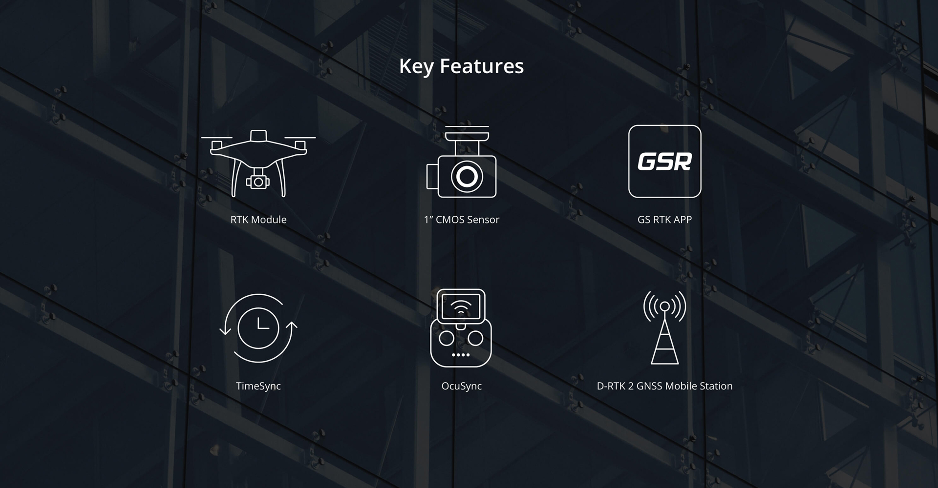
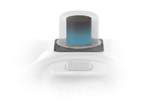
Un nuevo módulo RTK está integrado directamente en el Phantom 4 RTK, proporcionando datos de posicionamiento en tiempo real de nivel centimétrico para una precisión absoluta mejorada en los metadatos de la imagen. Además de la seguridad de vuelo optimizada y la recopilación precisa de datos, el Phantom 4 RTK almacena datos de observación satelital para ser utilizados para la cinemática postprocesada (PPK), que se puede realizar utilizando el servicio DJI Cloud PPK *. Ajuste el Phantom 4 RTK a cualquier flujo de trabajo, con la capacidad de conectar este sistema de posicionamiento a la estación móvil GNSS de alta precisión D-RTK 2, o NTRIP (transporte de red de RTCM a través del protocolo de Internet) utilizando un dongle 4G o punto de acceso WiFi.
Gather Accurate Data with TimeSync
To take full advantage of the Phantom 4 RTK’s positioning modules, the new TimeSync system was created to continually align the flight controller, camera and RTK module. Additionally, TimeSync ensures each photo uses the most accurate metadata and fixes the positioning data to optical center of the lens – optimizing the results from photogrammetric methods and letting the image achieve centimeter-level positioning data.
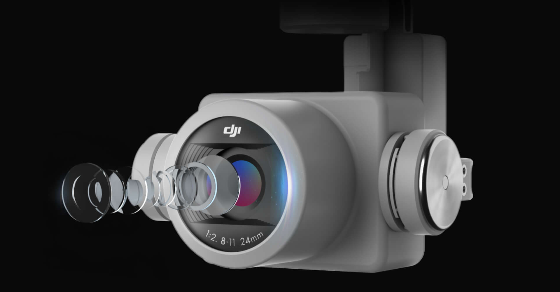
Capture the best image data with a 1-inch, 20-megapixel CMOS sensor. Mechanical shutter makes mapping missions or regular data capture seamless as the Phantom 4 RTK can move while taking pictures without the risk of rolling shutter blur. Due to the high resolution, the Phantom 4 RTK can achieve a ground sample distance (GSD) of 2.74 cm at 100 meters flight altitude.To ensure each Phantom 4 RTK offers unparalleled accuracy, every single camera lens goes through a rigorous calibration process, with parameters saved into each image’s metadata, letting post-processing software adjust uniquely for every user.
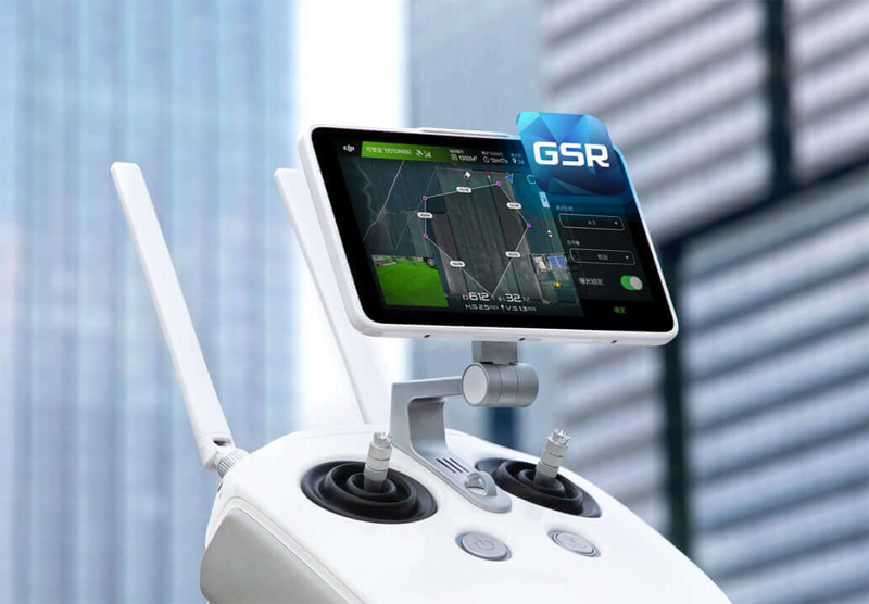
Purpose-Built Application
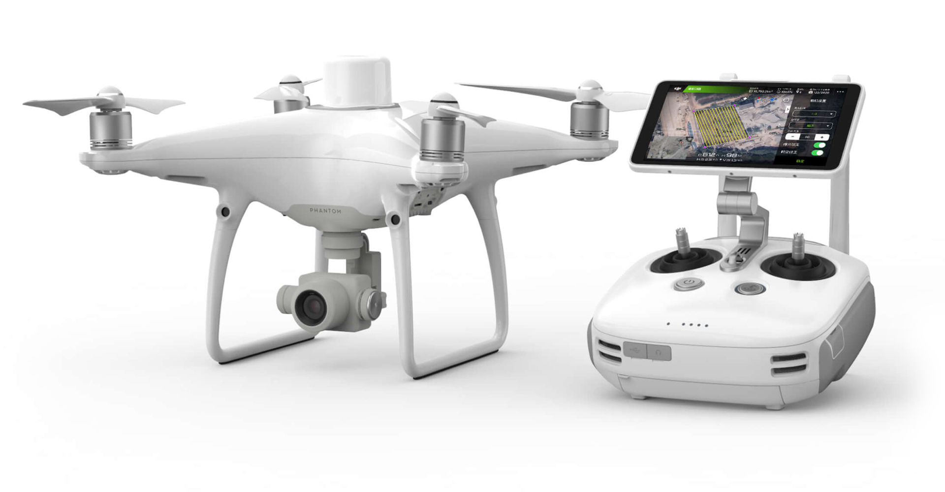
A new DJI GS RTK app and Remote Controller with built-in screen, giving users a streamlined control scheme for surveying missions and other data acquisition scenarios.The GS RTK app allows pilots to intelligently control their Phantom 4 RTK, with multiple planning modes, including Photogrammetry (2D and 3D), Waypoint Flight, Terrain Awareness, Block Segmentation*, and more. Users can also import KML/KMZ files to optimize the workflow for their missions.With the built-in screen, pilots can clearly view and plan their missions on an ultra-bright, 5.5-inch HD display.
*In some countries, local regulations do not permit Multi-Aircraft Control when executing Block Segmentation missions or require special approval. Please consult and follow the applicable rules wherever you operate.
Access a Variety of 3rd Party Applications
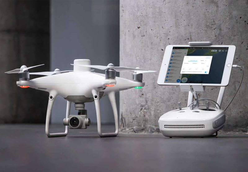
Pilots with experience using 3rd party apps on DJI drones can access the world's leading drone app ecosystem for their Phantom 4 RTK with the SDK Remote Controller. Users can plug in a compatible Android or iOS device and install any compatible DJI Mobile SDK-enabled app to harness the full power of their Phantom 4 RTK.
OcuSync Transmission System
Enjoy stable and reliable HD image and video transmission at distances of up to 7 km, great for mapping larger sites*.
*Unobstructed, free of interference, when FCC compliant. Maximum flight range specification is a proxy for radio link strength and resilience. Always fly your drone within visual line of sight unless otherwise permitted.
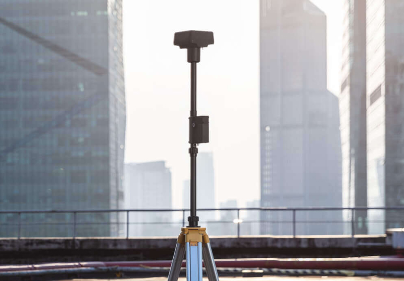
Seamless Compatibility with D-RTK 2 Mobile Station
Support your Phantom 4 RTK missions with the D-RTK 2 Mobile Station – providing real-time differential data to the drone and forming an accurate surveying solution, or acquire accurate location coordinates when used as an RTK rover. The Mobile Station’s rugged design and OcuSync transmission system ensures you can gain centimeter-level accurate data with your Phantom 4 RTK in any condition.
Contáctenos
Si desea comprar el producto o convertirse en un distribuidor, comuníquese con sales@scorpiondrones.com o deje sus datos de contacto y nos pondremos en contacto con usted a la brevedad.